[ Update: 3/6/2015. One of the drivers has plead guilty to manslaughter and agg assault in a deal ]
Killed while mowing the grass? Seriously, how often does this stuff happen? 52nd and Earll in Phoenix is a residential neighborhood:
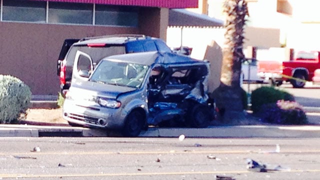
Jose Angel Gonzales, 17, and Esteban Chavez Jr., 16, were reportedly racing down a residential street near Earll Drive and 52nd Street (Phoenix) on March 26, when Gonzalez blew through a stop sign and collided with a Toyota pickup. The pickup crashed through a cinder block wall and hit Grijalva, 61, who was mowing a lawn. — azcental.com
Octavio Grijalva Herrera later died of his injuries. The teens have since been indicted on eight charges including manslaughter, endangerment; Chavez was also charged with leaving the scene.
Automobiles are frequently driven negligently and go careening all over the place; like the Maricopa county deputy who was speeding 81mph along a Glendale street recently… fortunately only 1 person was killed in that incident; as can be easily seen from the video it’s only a matter of coincidence and luck that more weren’t killed by the out-of-control vehicles.
—
The Arizona Republic had a nice, tear-jerking story reflecting on the victim. Phoenix landscaper killed by crash remembered, who was a veritable caricature of a hard-working immigrant (permanent legal resident; in case anyone was wondering). The story, as if on cue said “On this particular day, Hererra was in the wrong place at the wrong time.”, which is undoubtedly true.