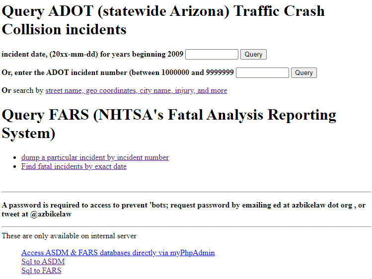
There is a search tool available, consider it in ‘beta’, for any Arizona reported crash involving a motor vehicle for any years between 2009 and 2022. And most, but not final 2023 is loaded (note it takes as much as many months to get into the database):
You can search by specific date, name of road, city, county, year, injury type, latitude/longitude. In addition to Arizona, the complete United States FARS (fatality only) is searchable but only by date.
In order to do any searching, you will need to request a password — either send an email, tweet at @azbikelaw, or leave a comment below (your email is in the comment but is not published). This is just a rudimentary way to keep ‘bots out.
Note that fatal Arizona incidents are tracked in detail here (Google Drive spreadsheet); And that FARS data includes PBCAT (more detailed crash types for pedestrian and bicyclists incidents), but lags behind — currently the most recent year available is 2020 (and 2019 has been updated with the “final” file).
Sample screenshot:
Crash Maps?
I have yet to find a suitable replacement for google fusion tables to make interactive crash maps; which were very feature-rich and allowed very useful (users could filter and sort and so forth) crash maps, but were discontinued in 2019. If anyone has ideas please contact me.
The info below about street names should no longer be a problem
When searching for specific street name, or names; be wary of some funny business … especially beginning around 2018(?).
SELECT OnRoad, count(*) FROM incident GROUP BY 1 ORDER BY OnRoad;
SELECT CrossingFeature, count(*) FROM incident GROUP BY 1 ORDER BY CrossingFeature;

SELECT OnRoad, CountyId, CityId, count(*) FROM incident WHERE OnRoad LIKE '%broadway%' GROUP BY 1,2,3 ORDER BY OnRoad;
Roads, the same road, shows up three different ways, For example “Broadway Rd” appears three different ways
-
Broadway Rd07 BROADWAY RD07E BROADWAY RD
(where some roads the E can be any other one-letter directional designation)
If i ever get around to it, i will re-process everything to strip away the prefix.
For the time being, a leading ‘%’ (precent sign) when searching does the trick
There has got to be a GIS database behind this. That would be the best way to get the big picture.
Does anyone have access to that?
So, yea… Google fusion tables made great maps; and had seamless filtering, etc. Unfortunately, Google discontinued then in 2019 and I still haven’t worked out or found a suitable replacement. https://azbikelaw.org/crashmap-data/